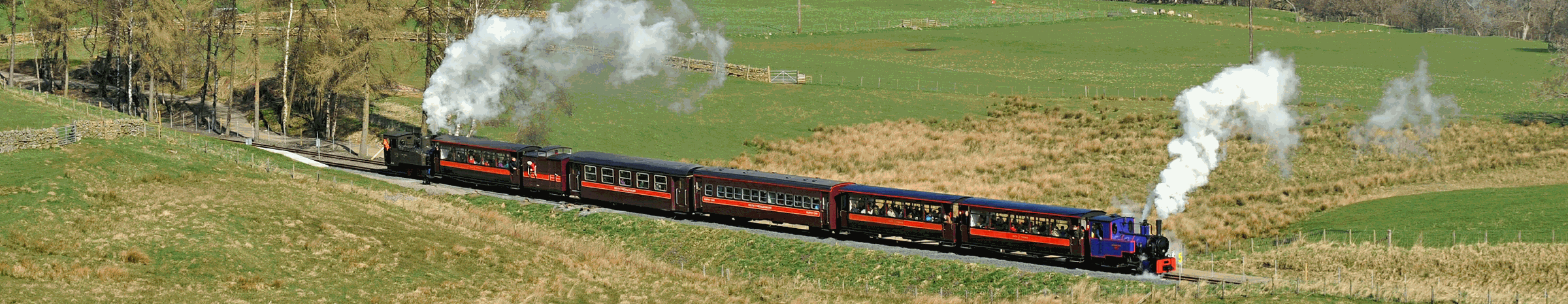


Go to South Tynedale Preservation Society Web-
From Alston
From Alston Station you can walk along the South Tyne Trail, or if you are feeling more adventurous take a walk into the town and follow circular walks either along the River South Tyne down to Garrigill (round trip approx 8 miles) or beyond, or alternatively follow the River Nent via Blagill and the waterfalls (round trip approx 4 miiles) or even continue all the way to Nenthead.
From Kirkhaugh
On a fine day there is nothing nicer than getting the first train to Kirkhaugh and
following one of the waymarked routes from the station with a stop en-
The Pennine Way
The Pennine Way National Trail, features 268 miles of chasing the Pennine Mountain tops along the rugged backbone of England, from the Peak District through the Yorkshire Dales and over Hadrian's Wall to the Cheviots. Amongst the finest upland walking in England the Pennine Way crosses the River South Tyne at Alston before running sightly to the west of the route of the South Tynedale Railway as far as Lintley where it crosses the access road to Lintley Halt before continuing north to Slaggyford and on towards Hadian’s Wall and the Cheviotts.
For more details of “The Pennine Way National Trail” follow the link to the National Trail website”.
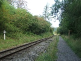
The South Tyne Valley Trail
Running for 23 miles from Haltwhistle to the Source of the Tyne, through a valley of outstanding scenic interest and variety, this is a fantastic journey that features in the local Walking Festivals. Suitable for walkers and cyclists the 13 mile section north from Alston follows the track bed of the former Haltwhistle to Alston branch. For details of the full trail please visit the “North Pennines” website or “click here” to open the walk information leaflet.
The section running beside the South Tynedale Railway has been upgraded with the aid of a grant through the Heritage Lottery Fund to provide a good walking surface and features wooden sculptures, information and activity boards, along with a picnic site roughly half way between Alston and Kirkhaugh. More information can be obtained by clicking on the “Nature on Track” leaflet.
Walking the Wider Area
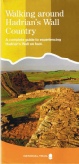
A leaflet was published in April 2006, entitled “Walking around Hadrian’s Wall Country
-
Although the leaflet not only covers walks along the route of Hadrian’s Wall, it also lists walks in the South Tyne Valley between Haltwhistle and Alston, following close to the route of the Alston branch railway.
The Haltwhistle Rings
The Haltwhistle Rings are a pack of 22 circular walks in and around Haltwhistle.
They are available from Tourist Information Centre's and local shops at £6.50 per
pack. They can be sent by post for £9.50 to include postage & packing or alternatively
download them. For more details or to download the walks please visit www.haltwhistlewalkingfestival.orgThe
walk leaflets covering the South Tyne Valley between Slaggyford and Alston are as
follows:-
Haltwhistle Rings leaflet 12: ‘This sweet solitude is difficult of access...’
Slaggyford – Merrie Knowe – The Hill – The Knar – Longdyke Head – Lintley Farm or Barhaugh Park
An amazingly varied 9 or 6-
Haltwhistle Rings leaflet 13: ‘Del Boy and Rodney’
Slaggyford – Williamston – Parsons Shields – The Bog – Eals – Glendue Burn – Pennine Way – Knarsdale – South Tyne Trail
Rodney Makepeace has farmed in this beautiful valley since he wore short trousers and is the current master of Knarsdale Hall. His dog, Del Boy, tends to get lost on a regular basis chasing rabbits. Should you see him while walking the 7 miles in this outstandingly varied valley, tell him to use his mobile to phone home!
Haltwhistle Rings leaflet 14: ‘A Roman Pile and a Black Forest Honeymoon!’
Alston – Pennine Way – Whitley Castle – Kirkhaugh – Randalholm
A 7-
Guided Walks with a Railway Theme
Local guide David Howe will be leading a variety of walks again in 2013 some of which are based on the South Tynedale Railway. For details please CLICK HERE.